
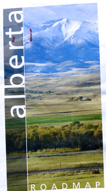
To my mind Alberta produces the best road map of any western province or U.S. state
If it ain’t broke, don’t fix it. In Alberta, that tired aphorism certainly doesn’t apply to a health-care delivery system that seems to change course every few years. But it’s definitely true of a provincial road map that has been pretty much unchanged over the decades. Which is a good thing, because it works brilliantly well. Indeed, I think it’s the best, most-user friendly official highway map produced by any state or province in western North America.
I love highway maps. They are the backbone of any road trip, from the preliminary planning stages to figuring out how far you are from the next town and pulling over for a bathroom break or meal. GPS devices, with their monotone digital voices, are great inventions, especially for finding specific addresses in big cities. But I can’t ever see them replacing paper maps for open-road motoring.
When I’m driving, I like folding up the map into a small rectangle that just shows the immediate road ahead. Of course, this eventually leads to paper tears along the creases. Better paper would help, but I just replace the maps for free every couple of years from a tourism or AAA/CAA office. One drawback of the latter’s offerings is they tend to put two states on each map, one on each side. I much prefer the official state maps, with the big picture of all the highways for that state on one side and the detailed city maps and other information on the other.
Having traveled extensively through western North America, I’ve had the opportunity to use about a dozen of these state and provincial road maps and compare notes. There are many things that go into the making of a good highway map. But by far the most important is ease of use.
When you’re driving, you have maybe a couple of seconds to glance down at the map in your lap, usually without the aid of your reading glasses. So it’s vital to be able to easily read the map. You’d think this would be blatantly obvious to the mapmakers. But some places do a spectacularly bad job of it, particularly if you’ve got aging eyes that don’t read fine print well.
They can all take a lesson from Alberta. The one thing mapmakers there have done particularly well is use a very light-coloured background, ranging from white in the prairies to the palest of greens in the foothills and a slightly darker yellowish green in the mountains. They’ve also used a fairly dark black font for towns, which is nicely enlarged and bolded for cities. A red font is used for provincial and national parks. What this means is it’s relatively easy to quickly find what you’re looking for.
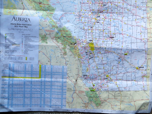
My heavily used and marked Alberta road map is easy to read
By contrast, Utah, for instance, uses maddeningly light fonts for towns, mountains, forests…. everything. In Arizona, the background colours are too dark and the metropolitan names a jumble of large, almost overlapping print. Colorado also uses too dark a shade of green for mountainous regions, though, like some other western states, it does a nice job of highlighting scenic routes with bold dots. Idaho and Wyoming do deserve props for using weather-proof paper and bold black for their place names.

This enlargement makes it more legible, but Utah’s road map is hard to decipher

Good luck trying to navigate with this map around Phoenix’s suburbs

There’s a lot of dark colours in Colorado’s road map, but at least it does a good job of highlighting scenic routes
A few other things I like about Alberta’s map. Like some U.S. states, it provides population numbers in the index for all cities and towns. And the back of the map is totally devoted to detailed maps of all provincial cities and major resort communities. Interesting tidbits like the communities’ area and elevation are included here.

The back of Alberta’s road map shows detailed maps of every city and major resort community
The map for the neighbouring province to the west, British Columbia, does an even better job than Alberta of highlighting the names of its major communities. But it commits the unpardonable sin of splitting the map, so the more heavily populated southern portion is on one side and the northern portion on the other. And there’s no detailed maps for the two largest cities: Vancouver and Victoria.

It’s the third largest city in Canada. Don’t you think Vancouver deserves a more detailed inset map than this?

Good article. One of the things I like to do is to mark the emergency contact numbers (911) at the front bottom of the maps. Some use 911, but a lot have various other emergency contact numbers.
LikeLike
Hey Bill. I think I missed my calling for my undergrad degree — I should have majored in geography — over the decades it’s become clear that, by nature, I’m a ‘map guy’.
For un-paved roads, I’ve used a great source while road tripping in the US. Each USDA national forest has a Forest Visitor Map. Great fun finding a FS road that takes off from a tertiary paved highway and then eventually loops back to that (or another) paved road. These loops have taken me to some lovely quiet ‘guerrilla’ camp spots.
LikeLike