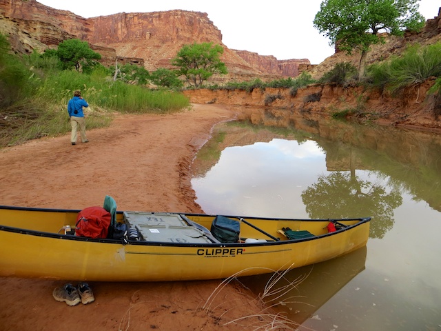
Great, leisurely paddling down Utah’s Green River
The primary purpose of any road trip isn’t simply to eat. Unless, of course, it’s me. But if I’m not on an intense road-food research journey, I, too, have other priorities: hiking, backpacking, exploring new landscapes.
But canoeing? I hadn’t paddled down a river in two decades. So when a friend asked if I was interested in joining a canoe trip down the Green River, in southeast Utah, my only question was “How hard is it?”
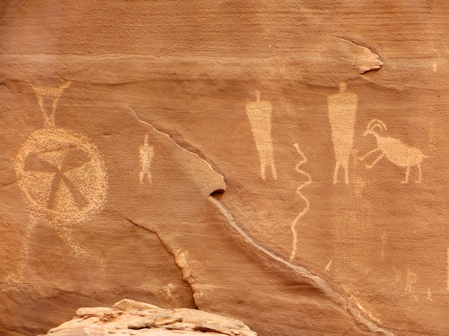
A pretty easy float, requiring rudimentary paddling skills, was her reply. That’s all I needed to know, since I already love Utah’s desert country. Cruising down through high sandstone walls, with all the weight in a boat, rather than on my back, sounded like an ideal way to spend 10 spring days, with the added bonus of native petroglyphs and canyon hiking sidetrips along the way.

Plenty of ancient petroglyphs along the way

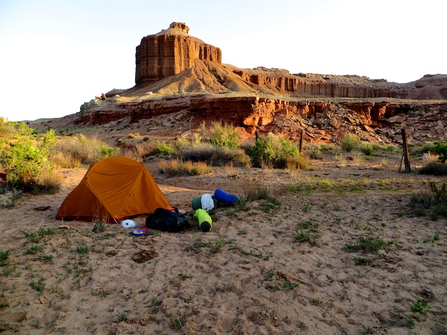
Morning hike from a backwater camp
So how hard was it? Pretty mellow, with the bows-people doing as much gawking/picture taking as paddling. When both people were paddling, you could increase the natural current speed of about three miles per hour to five, so the miles slipped by pretty effortlessly. The only concerns were wind gusts that could potentially dump unprepared paddlers and the last wee bit where the Green joins the bigger Colorado River.
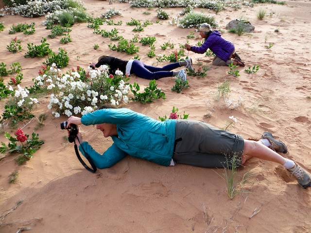
When’s the best time to go? We went in late April-early May, when the river flows are good (though not nearly as high as the June runoff peak. After that, you run into bug problems plus heat). In late spring, the river’s cold but the air temperatures are generally pleasant, though the nights at 4,000-plus feet can be cool, as can the days on the river if the wind is blowing and it’s cloudy. Did I mention the desert flowers are pretty spectacular in spring?

Blooming flowers always draw a photo crowd, sand be damned

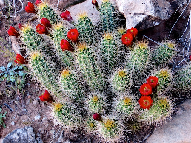
A desert miracle: the claret cup cactus in bloom
How’s the camping? Mostly lovely. There are lots of potential campsites. Just look for shady cottonwood trees, tracks up sandy banks, little backwater entrances or maybe some flat rock ledges overlooking the river. It’s first-come, first-serve, however. So an early start (when the light’s good) and an early afternoon stop are the best bet for claiming prime sites, though things get busier closer to the confluence with the Colorado as the canyon walls get higher and the hiking gets better.

Pretty luxurious backcountry camping with a table and propane stove
Two things worth mentioning here. You’d best not mind getting dirty, maybe even filthy. That’s because sandstone is made of, surprise, sand, which you’ll find at nearly every campsite. It tends to cling to clothing, seats, pretty much everything it touches. If the wind kicks up, you’ll find it seeping into your tent and maybe your mouth. Tip: Take your oldest/least expensive gear, stuff you don’t mind getting beat up. I had to replace a sand-scratched pair of sunglasses after the trip. Luckily, they were old and cheap.

Hope you don’t mind getting sand in everything
Second, you may not have heard of tamarisk before dipping a paddle into the Green. But you’ll soon be intimately familiar with this invasive, thick shrub, which in typical fashion was once introduced to control bank erosion and is now being battled with beetles, with limited success. From a canoeing perspective, it means not being able to land or camp at many otherwise great spots.

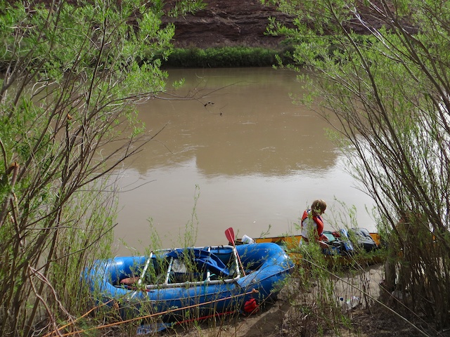
A break in the tamarisk to beach our boats
What’s a good stretch of the Green River to paddle? We put in at Crystal Geyser, just south of the town of Green River. In retrospect, we might have been better served to start at Mineral Bottom (a few days paddling downstream). The best scenery and hiking are downstream of here, in Canyonlands National Park, plus it gives you more time to spend an additional day or two at places that offer good hiking or just relaxing in superb settings.

Hiking high above the Green River
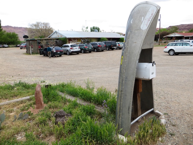
Can I bring all my own paddling paraphernalia? Yes, but I wouldn’t bother, especially if you have to transport your canoe/s a long distance. Just contact Tex’s Riverways in Moab. They’ll rent you canoes, life jackets, paddles, food boxes, water jugs and mandatory toilets, plus drop you off and transport you back, by jetboat up the Colorado River. It cost those of us who went this route about $350 for a 10-day trip. They run a tight ship and have lots of good advice about camping sites and where to find native rock art and hiking opportunities.

Tex’s Riverways, in Moab, is a one-stop shop for everything you’ll need to go down the Green River